Doubt and Uncertainty at the Corrieyairack Pass in August 1745
The Mountain Roadway joins the Great Glen and Speyside
The old drovers' 25 mile route across the Monadhliath Mountains through the Corrieyairick Pass was upgraded in 1731 by General Wade in the aftermath of the 1715 Jacobite Rebellion. But ironically its first military use was down to Wade's opponents - the Highlanders led by Bonnie Prince Charlie in August 1745. And the weather ....
History tells us that if Cope, who had marched to Dalwhinnie on news of the Prince's arrival, had taken the route himself across to Forts Augustus and William .... well, he might have frustrated the '45 before it got much further than the Great Glen. But Cope had false intelligence that the Highlanders had already occuupied the Pass and were lying in wait for him. So, after summoning all his officers to council, they unanimously resolved in writing to head for Inverness then Aberdeen and thus back to the Lowlands by barge - rather than attempting to engage the enemy in the Pass.
Such a decision meant that the Prince could indeed slip behind Cope and reach Perth then Edinburgh before Cope could make his return to the capital.
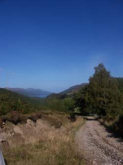
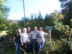
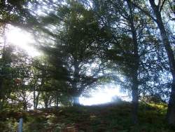
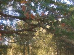
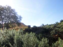
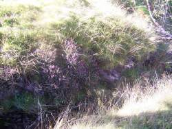
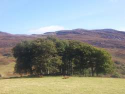
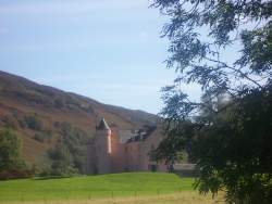
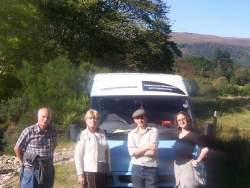
Cope's Council at Dalwhinnie and the Prince's unimpeded transit across the Pass will both be recorded on the Prestonpans Tapestry. To ensure the necessary sign off, Trustees visited the west end of the Pass close by Fort Augustus climbing just a mile or two up to and beyond Cularchy House, as pictured below. They had Stephen Lord to guide and delight them as he recalled his own journey along the Prince's route a decade earlier.
click to enlarge the pictures
__________________________________________________________
Editor: Once the road was completed in 1731 the Pass was crossed regularly. One such user was the Minister of Laggan who was courting a lady in Fort Augustus. She did eventually consent to become Mrs Grant so his determination was well rewarded. And determination it was he needed. One user wrote: "The whole road is rough dangerous and dreadful, even for a horse. The steep and black mountains and the roaring torrents rendered every step my horse took frightful, and when we attained the summit of the zig-zags up Corrieyairack I thought that the horse, myself and all would be carried away, so strong was the blast. It's even true that soldiers occasionally die on the Pass from over-fortifying themselves with whisky!"
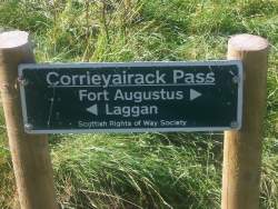
The route for the Corrieyairack Pass runs from just south of Fort Augustus to Melgarve west of Laggan in Speyside.
FORT AUGUSTUS APPROACH
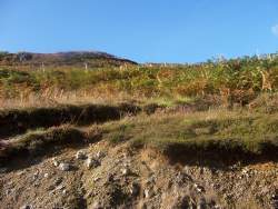
General Wade's road now starts near the south end of Loch Ness at 60 metres [some 200 feet]. It climbs south-west at first to get round the Culachy Burn, passing a fine series of waterfalls. After this it turns south-east and begins the first of the many zig-zags it uses to reach the summit of the pass. The ascent is extremely steep, and the surface is quite rocky. There are brilliant views of the Great Glen and Loch Ness as one climbs higher and higher. Eventually as one climbs completely clear of the Glen the scenery is more forbidding, arriving at the summit at 775 metres, or some 2500 feet above sea level. But the toughest part is not yet over even though all the rest is downhill. The descent is very steep and rocky, with sharp zig-zags in the steepest sections.
GARVA BRIDGE APPROACH
A good road runs to Garva Bridge from Laggan. As one approaches the Wade road is clearly visible, climbing steeply up the hillside. One of the original Wade bridges is just to the north. The first section is completely straight but after that the track begins a series of eleven zig-zags to get to the top. The fact that the course of these zig-zags is still in place indicates just how well the road was surveyed in 1730. Looking back one can see right over Speyside to the Cairncorms with the River Spey far below.
Published Date: October 6th 2009
|